Guide to Valencia Metro…
Underground / Subway
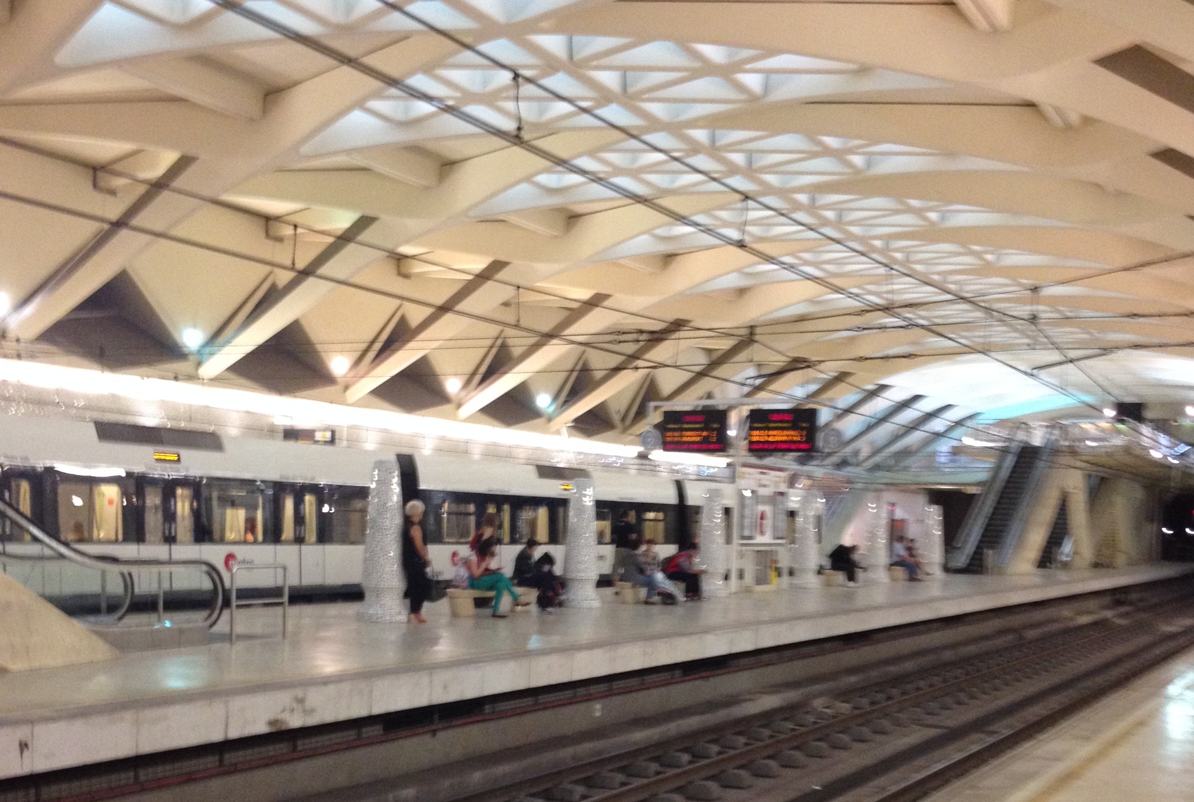
The Valencia metro is very modern and easy to use and each line has a distinct color.
Using the metro is the easiest and quickest way to get into town from the airport and also the cheapest.
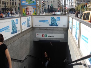
Xàtiva metro station is just a few yards from Estacion del Norte which is in the center of town.

The two lines which conncet to the airport from the city center and the port are the red line 3 (Rafelbunyol-Aeroport) and the green line 5 (Marítim Serrería – Torrent Av. / Aeroport).
Tickets cost €4.90 which includes €1 for the card which you can top up.
From Alameda station (which was designed by the Valencian architect Calatrava) their paths diverge.
Trains from the airport to the city center take approximately 25 minutes. There are 5 lines with the sixth line (Line 2) due for completion in 2014-15.
This partially completed tram and metro line will run from Tavernes Blanques (South) – Natzaret.
Línea 1: YELLOW
Llíria/Bétera – Torrent Avinguda/Villanueva de Castellón
Línea 3: RED (Rafelbunyol-Aeroport)
 Line 3 runs between the airport and the city center, the port and the main locations in the metropolitan area.
The station is on the ground floor of the regional flights terminal.
It has links with the lines L1, L4, L5 and L6.
The train stops at many places including Xativa Station, Calle Colon and Alameda Station in the Turia Gardens.
L3 relevant stations Download Valencia Metro Map
- Levante Stadium – Machado
- Campus of Blasco Ibáñez (University of Valencia), Chiron Hospital and Clinic – Facultats
- Commercial Area – Columbus
- North Station and Plaza de Toros – Xativa
- Central Police, General Library – Angel Guimera
- General Hospital – Nou d’Octubre
- Manises Hospital – Salt de l’Aigua
- Valencia Airport – Aeroport
Línea 5: GREEN (Rafelbunyol-Aeroport)
Neptú ~ Marítim-Serreria – Aeroport/Torrent Avinguda
Runs directly from the airport to the port of Valencia and the town of Torrent. The station is on the ground floor of the regional flights terminal.
It has links with the lines L1, L3 and L6.
L5 relevant stations – Download Valencia Metro Map
- Port of Valencia – Neptú and Grau-Canyamelar
- Garden Ayora (Ayora and amistat) – Ayora
- Valencia Football Stadium-CF (Mestalla) – Aragon
- Commercial Area – Columbus
- North Station and Plaza de Toros – Xativa and Bailen
- Central Police, General Library – Angel Guimera
- General Hospital – Nou d’Octubre
- Manises Hospital – Salt de l’Aigua
- Valencia Airport – Aeroport
- Central Traffic, Interim Station AVE – Joaquin Sorolla
- Hospital Peset Aleixandre – Safranar and Patraix
- Commuter Xirivella Utiel and affected by the construction of the AVE – Sant Isidre
Línea 6: PURPLE
Tossal del Rei-Maritim Serreria) shares Pont de Fusta-Doctor Lluch section with T4.
Stops include the University of Valencia, Universitat Politècnica, Port of Valencia, Marina Real Juan Carlos and Grau-Canyamelar Station and the beach.
Línea 4 : BLUE – Tram
Mas del Rosari/Ll. Llarga/Fira – Dr. Lluch
Stops include the Feria Valencia (Trade Fair) Station, Torres de Serranos, University of Valencia, Universitat Politècnica, Palacio de Congresos and the beach.
 The tram is part of the Valencia metro system.
It’s an easy way to get to the beach as the tram is easy and quicker than the bus.
Which Ticket Should I Buy?
There are a variety of tickets to choose from ranging from one day tickets to travel cards.
- For families with children under the age of six, two children are allowed to travel free with each adult.
- Consider how long you’re going to be here before deciding which one is best for you.
- For example, if you’re here for just one day and need to use the transport a lot then buy a T-1 ticket.
- This gives you unlimited access to travel in the center of town.
- For more than one day it’s best to buy the T-2 or T-3 which are for two or three days respectively. These are combined tickets valid for both the underground and buses and are non-transferable as they permit unlimited journeys for one person. Cost between €4 and €9.70.
- For one journey just buy a single ticket.
METRO TRAVEL CARD
The bonometro is valid for 10 journeys on the metro and available for all zones. You can buy one of these cards at metro stations and automatic vending machines.
- When you’ve finished using the card don’t throw it away as you can top it up for 7.35 euros.
- You can also use the travel card for more people. Just pass it to the person following you and they can scan it.
- If you buy the 10 trips add another €2 for the card.
- Then when you run out of rides you just top it up. You can only travel through the zones you have purchased.
The following information is in English and Spanish.
TICKET PRICES, VALENCIA METRO MAP & PLANNER
Prices of tickets for the Metro in Valencia >>
Download Valencia Metro Map >>
You can also use the bonobus on the metro. To find out more check out our page on transport in Valencia.
TIP! – With the VLC Tourist Card you can enjoy unlimited free public transport around the city (including the Valencia-Airport route) PLUS you get great discounts on museums, leisure activities, shopping and restaurants. Offers unlimited use of bus and metro for one, two or three days and it can be purchased at hotels, tourist offices and online – See Valencia Travel Cards.
You may also like:
Valencia Map
Valencia Travel
Valencia Accommodation